


Precinct 14, Carter County, Montana
About
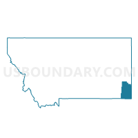
Outline

Summary
| Unique Area Identifier | 611858 |
| Name | Precinct 14 |
| County | Carter County |
| State | Montana |
| Area (square miles) | 1,923.33 |
| Land Area (square miles) | 1,919.47 |
| Water Area (square miles) | 3.85 |
| % of Land Area | 99.80 |
| % of Water Area | 0.20 |
| Latitude of the Internal Point | 45.74379700 |
| Longtitude of the Internal Point | -104.53052990 |
Maps


Graphs
Select a template below for downloading or customizing gragh for Precinct 14, Carter County, Montana


Neighbors
Neighoring Voting District (by Name) Neighboring Voting District on the Map
- Precinct 1, Carter County, MT
- Precinct 1, Powder River County, MT
- Precinct 11, Powder River County, MT
- Precinct 11, Custer County, MT
- Precinct 12, Custer County, MT
- Precinct 13, Carter County, MT
- Precinct 3, Carter County, MT
- Precinct 4, Fallon County, MT
- Precinct 7, Fallon County, MT
- Precinct 8, Fallon County, MT
- VTD-precinct -CampCrook, Harding County, SD
Top 10 Neighboring County Subdivision (by Population) Neighboring County Subdivision on the Map
- Baker CCD, Fallon County, MT (2,522)
- Ekalaka CCD, Carter County, MT (758)
- North Harding UT, Harding County, SD (548)
- East Powder River CCD, Powder River County, MT (432)
- Alzada-Boyes CCD, Carter County, MT (402)
- Plevna CCD, Fallon County, MT (368)
- South Harding UT, Harding County, SD (314)
- Shirley-Ismay CCD, Custer County, MT (280)
Top 10 Neighboring Place (by Population) Neighboring Place on the Map
Top 10 Neighboring Elementary School District (by Population) Neighboring Elementary School District on the Map
- Broadus Elementary School District, MT (1,371)
- Ekalaka Elementary School District, MT (878)
- Alzada Elementary School District, MT (159)
- Hawks Home Elementary School District, MT (107)
- Spring Creek Elementary School District, MT (101)
- Trail Creek Elementary School District, MT (42)
Top 10 Neighboring Secondary School District (by Population) Neighboring Secondary School District on the Map
- Custer County High School District, MT (11,699)
- Powder River County High School District, MT (1,759)
- Carter County High School District, MT (1,144)
Top 10 Neighboring Unified School District (by Population) Neighboring Unified School District on the Map
- Baker K-12 Schools, MT (2,470)
- Harding County School District 31-1, SD (1,255)
- Plevna K-12 Schools, MT (420)
Top 10 Neighboring State Legislative District Lower Chamber (by Population) Neighboring State Legislative District Lower Chamber on the Map
Top 10 Neighboring State Legislative District Upper Chamber (by Population) Neighboring State Legislative District Upper Chamber on the Map
Top 10 Neighboring 111th Congressional District (by Population) Neighboring 111th Congressional District on the Map
Top 10 Neighboring Census Tract (by Population) Neighboring Census Tract on the Map
- Census Tract 1, Fallon County, MT (2,890)
- Census Tract 9613, Custer County, MT (1,905)
- Census Tract 1, Powder River County, MT (1,743)
- Census Tract 9687, Harding County, SD (1,255)
- Census Tract 3, Carter County, MT (1,160)
Top 10 Neighboring 5-Digit ZIP Code Tabulation Area (by Population) Neighboring 5-Digit ZIP Code Tabulation Area on the Map
- 59301, MT (11,404)
- 59313, MT (2,498)
- 59317, MT (1,164)
- 59324, MT (821)
- 59344, MT (300)
- 57724, SD (210)
- 59336, MT (192)
- 59311, MT (159)
- 59332, MT (146)